
or This post is NOT about healthcare in Cuenca, Ecuador
We know we said in the last post that we would discuss our experiences with healthcare here in Cuenca, Ecuador in this post. And we know some of you have been anxiously awaiting said post with almost as much as eagerness as your annual viewing of “How the Grinch Stole Christmas” on network TV. Now before you get your knickers all in a twist, there still will be a post about our healthcare experiences but just not this time. Glenn will be visiting an opthomologist next week and we want to include his experience in the post. By the way, you can watch the Grinch any old time!
Well now that you are done hyperventilating over the disruption of your blog expectations, let us tell you what this post is about. Last week, we were delighted to have an impromptu road trip to a the next valley over from Cuenca with our Landlady Susana.
The car trip took us to the east and north on the autopista (Cuenca’s version of a freeway) or Highway 35. Depending on what map you look at, it either IS a part of the Pan American Highway or it runs parallel to it – kind of like Route 66 and Interstate 40 in the US. Eventually we did turn off of this limited access express way, crossed the Rio Paute and were on the REAL Pan American Highway. Unfortunately, as we were riding in a car, there are no pictures. Qué lástima! (What a pity!) But here’s a map!
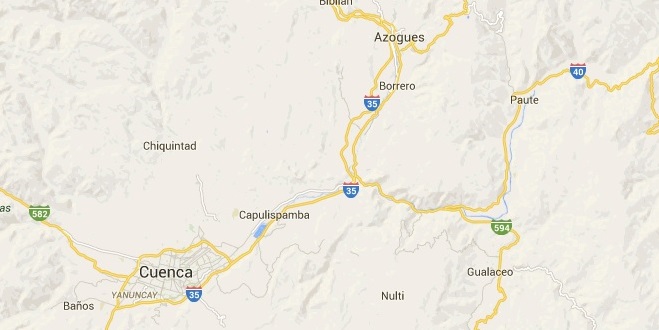
We turned off of the highway about 14 kilometers from Cuenca into a community called Challuabamba. According to Susanna, many Americans are buying and/or building homes in this area. More well to do Ecuadorians also live here because even though Challuabamba is difficult to say, it is a very easy commute into Cuenca and is quite a bit more peaceful. We enjoyed looking at the many different styles of houses and beautiful landscaping of these suburban homes. In the above map, Challuabamba is not shown but it is near Capulispamba.
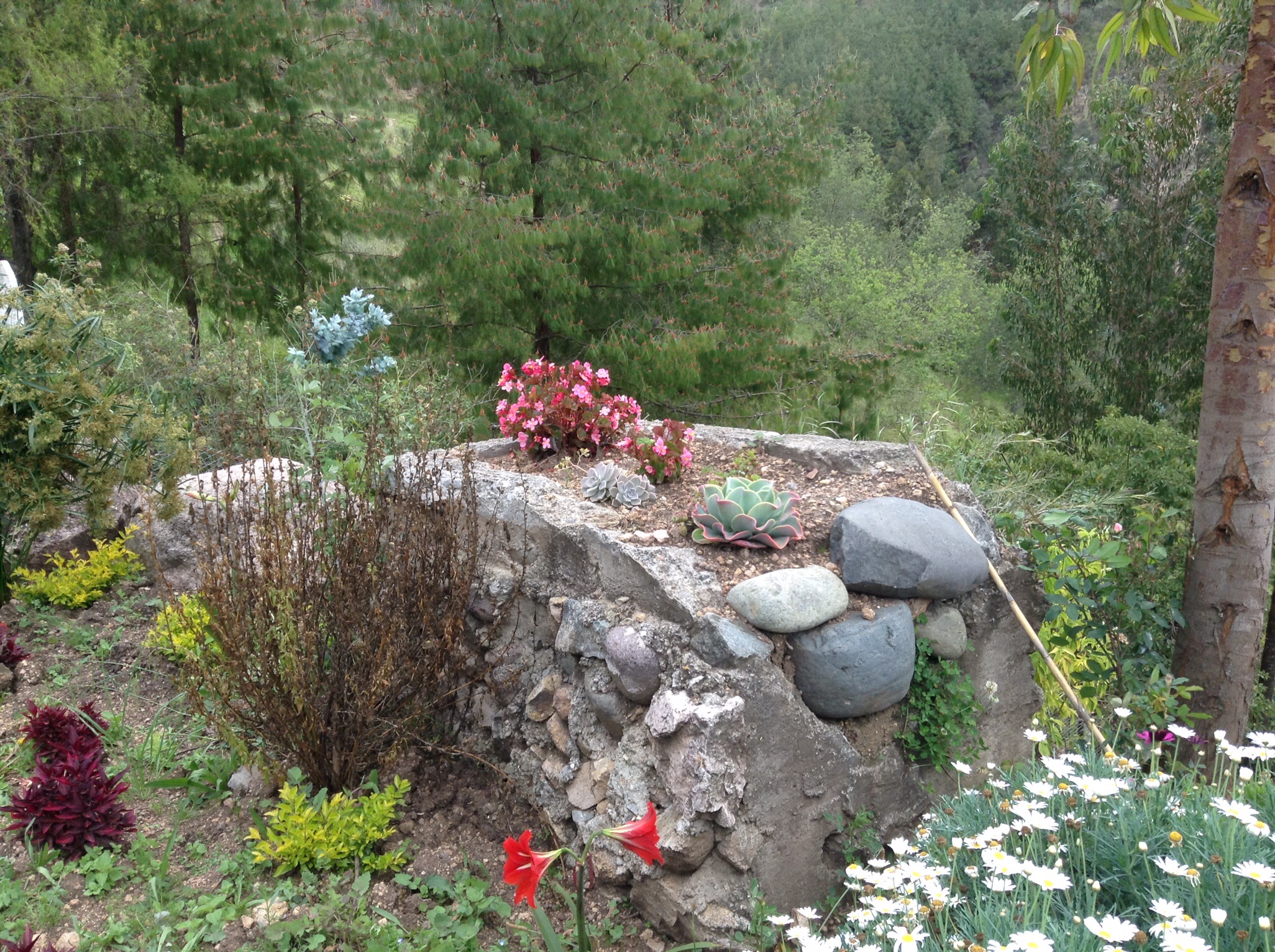
When we finished our gawking, we started toward the town of Azogues but headed up the mountainside before we got there. Susana was taking us up to the house she is building for her son Chris who lives in Canada at this time. It was payday for her workers and Susana was the paymaster. We climbed and climbed and finally reached our destination. Although the house is fairly small, it has killer views across a broad valley (which we cannot find the name of – sorry). It is so high up, you can actually see the northeast part of Cuenca!


Here’s a panoramic view of the valley.
When Susana is not doing a million other things, she is an avid gardener. The pictures below are just a very few of the plants she has planted as landscaping for Chris’ house. There are fruit trees (lemons, apples, tomate de arbol, and more), various palms, succulents, herbs, and many different flowers.


We completed our trip with an almuerzo (lunch), of course, and headed back into Cuenca. We hope to get out into more of the surrounding area of Cuenca very soon.
Our regular readers will recall that in our last post we mentioned having received our visas and that our next step was to get our cedulas. Well, it’s done! Lots of waiting: for our number to be called; for our facilitator to go get another notarized copy of our passports; and waiting until after lunch to get our cards because the machine that makes them was “having a problem.” But that’s all water under the bridge. We have our visas and cedulas and probably the ugliest pictures on an official document ever. Take a gander.
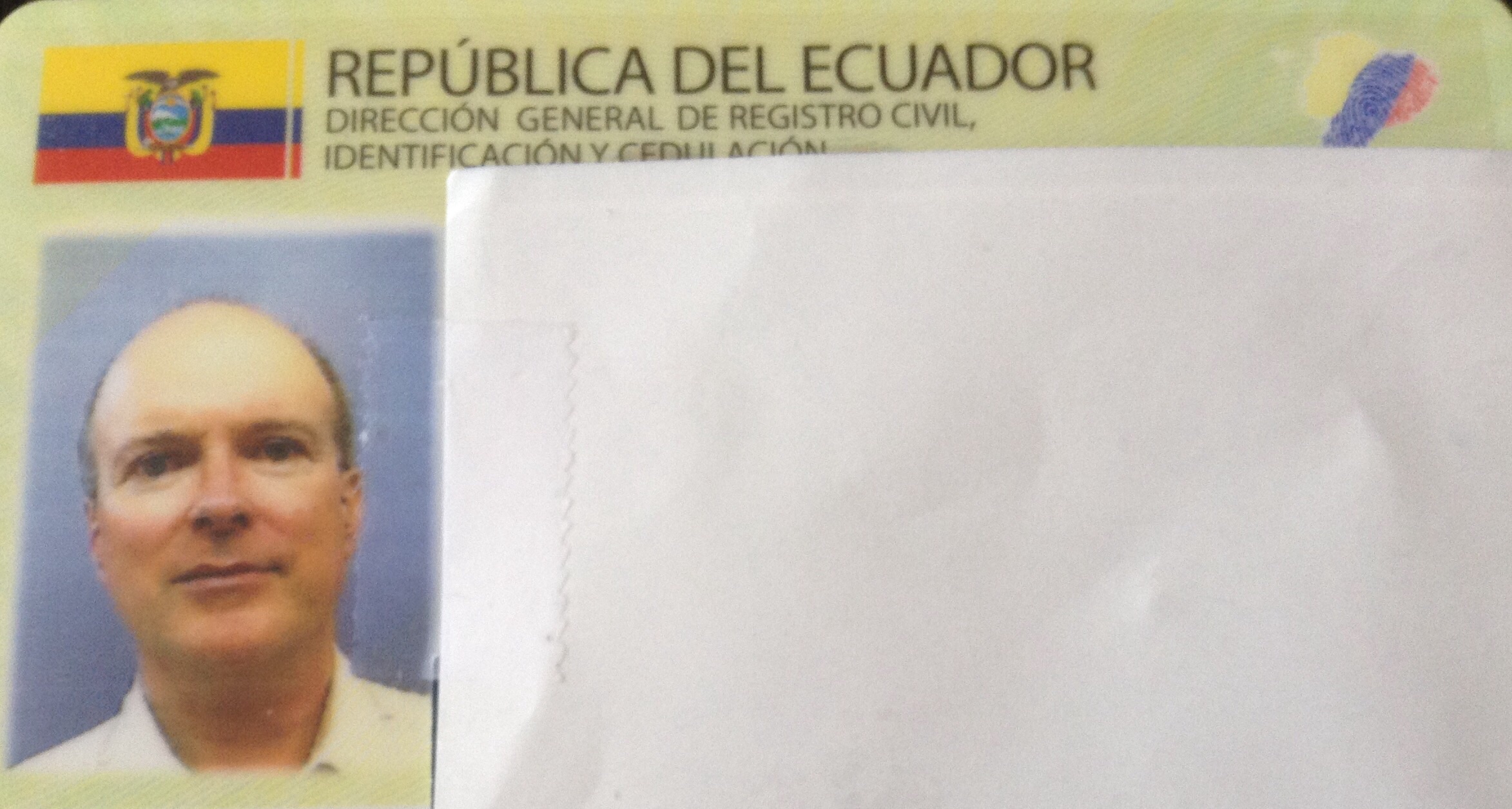

We both look like lifers with no chance for parole.
Here’s What We’ve Learned: Smiling for official photos in Ecuador IS NOT ALLOWED!
Here’s What We Need to Learn: To keep our schedule more open so that impromptu road trips can happen more often!

I liked that video, and love the pictures of you and Glenn on your cedulas!
LikeLike
Thanks, Lance. Those pictures are scary, aren’t they?
LikeLike
I wish I understood the ban on smiling – so counter to the Ecuadorian way of being! BTW, did you know that my husband and I own a little rustic casita in Challaubamba? We have only had our apartment in town since the summer! So nice that you got to see some of the beautiful surrounding areas……..
LikeLike
Thanks for reading, Sheila. Challaubamba is a very beautiful spot.
LikeLike
Many more to come! We have a beautiful country to explore and many more people to meet. Life it tough… then you move to Ecuador,
gg
LikeLike
Thanks, Gary. Lots more to come!
LikeLike
Mara, I think that’s the first time in your adult life that I’ve seen a bad picture of you…but of course I’ve never seen your Costco photo. I don’t think anyone has a good one of those! As always, love my weekly trip to Ecuador.
LikeLike
It is hideous, isn’t it. My Costco picture is actually not that bad. Thanks for reading. I look forward to your really coming to Ecuador next year.
LikeLike
I’m in trouble on the no-smile rule.
LikeLike
I know. It’s tough.
LikeLike
–Is Joe Machkii the David Crosby of Crosby Stills and Nash?
–Are you in the government witness protection plan?
LikeLike
No, Joe and David are not the same person but I thought Joe looks like David Crosby, too! If we were in the gov’t witness protection program, I think we would have blown our cover already! Thanks for reading.
LikeLike
Always a joy to read your posts and see your images! The video is pretty cool.
So you mention two places that end with “amba.” Does the common ending mean something? You know like “stan” means land?
What a blessing to be invited on an impromptu journey! Your landlady sounds very nice as well as energetic. 🙂
LikeLike
Hi Jami, Thanks for reading and for your intriguing question. I did a little (not much) research and found that “bamba” is an alternate spelling of the Quechuan word pampa which means “plain”. But whether that is part of the meaning of the names of the places I mentioned, I do not know.
LikeLike
A lovely break from our gray, dark days!! Merry Christmas! nancy speedy Date: Sun, 7 Dec 2014 02:09:26 +0000 To: speedynca@hotmail.com
LikeLike
Thanks for reading, Nancy. And Merry Christmas to you and your family!
LikeLike